26/3/2026
The 3DUR26 seismic survey, carried out under ANCAP’s multi-client agreement with CGG Services US Inc (Viridien), began on March 1 with the deployment of streamers from the seismic vessel BGP Prospector. The operation is supported by the supply vessel Moonrise G and the Uruguayan-flagged chase boat WP Halle. On March 6, the seismic source was deployed for the first time, followed by testing and calibration, and the first data was acquired the next day. By Sunday, March 22, a total of 564 km² of seismic data had been collected, representing 22% of the target for season 1.
The project has environmental authorization (AAP) under Ministerial Resolution No. 1482 of December 5, 2025, and its environmental management plan was approved by Ministerial Resolution No. 170 of February 27, 2026, issued by the Ministry of Environment (more information available at the Observatorio Ambiental Nacional)
The marine fauna observation team began recording sightings on February 25. Between that date and March 22, a total of 207 sightings and 31 detections through passive acoustic monitoring were reported. In 17 of these events, the start of the source was postponed, and in 40 cases the source was shut down due to fauna presence within the mitigation zone. In the remaining sightings and detections, no action was required (either the source was off or the fauna was outside the mitigation zone). No environmental or health and safety incidents were reported during this period. Due to the mitigation measures implemented, additional data acquisition (infill) may be required in this or the next season of the survey.
Additionally, on March 5, 6, 11, and 13, 2026, whale carcasses in an advanced state of decomposition were observed during monitoring. Of the four carcasses recorded, only one could be taxonomically identified, corresponding to the species Megaptera novaeangliae (a fragment of the caudal fin was documented). On March 13, partial remains of a whale and a carcass of Mola mola were recorded during the recovery of the source array for maintenance. Due to the advanced decomposition of the carcasses, it was not possible to determine the cause of death. The observed characteristics indicate that these events occurred prior to the ongoing seismic activities, with no evidence of association between the records and the operation.
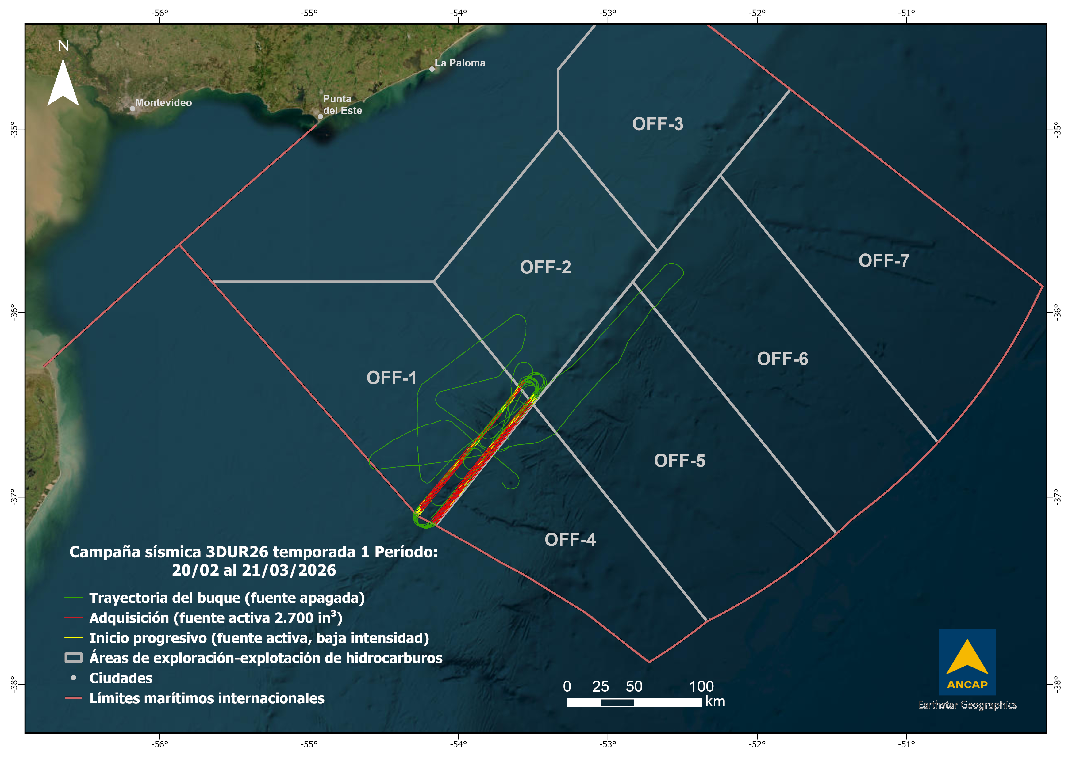
The map shows the trajectory of the seismic vessel during the period, indicating the positions where the source was activated for data acquisition or soft start (low-intensity source), as well as line changes (source off).