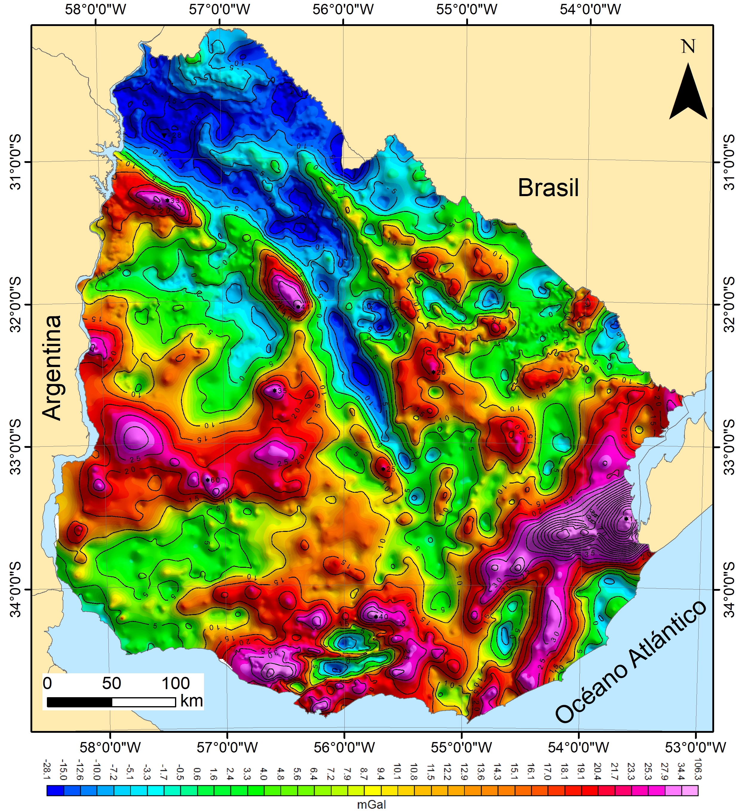
Updated Bouguer gravity anomaly map of Uruguay, presented at the X Uruguayan Geology Congress (2022). It was prepared based on data obtained from gravimetric stations measured, between 1950 and 2018, by ANCAP, the Military Geographic Service, the National Directorate of Mining and Geology (DINAMIGE) in cooperation with the Federal Institute of Geosciences and Natural Resources of Germany (BGR for its acronym in German), the College of Engineering of the University of the Republic and the company Campo Alegría.
Article presented at the X Uruguayan Geology Congress:
Nuevo Mapa de Anomalía Bouguer del Uruguay.pdf
Dataset grid used:
Mapa Anomalia_Bouguer.jpg