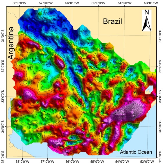
ANCAP acquired gravimetrical data between 1950 and 1956 in the Norte Basin and Santa Lucía Basin. Then, in a process of continuous improvement, new gravimetric data was acquired in those Norte Basin’s regions where a better detail was required to analyze the geological aspects. In that sense, new measurement stations were located in the region next to Pepe Núñez (2013), Clara (2014) and Guichón (2017).
The magnetoteluric surveys (MT/AMT) were acquired by the company Ingesur SRL within the project for the Sectorial Fund of Energy – ANII-ANCAP named “Subsoil prospection based in geophysical methods in continental sectors of hydrocarbon potential existence” which was held during the years 2010 to 2012. During this project, MT surveys were performed in the region of Pepe Núñez (71 surveys); Quintana (6 surveys); Salto-Belén section (12 surveys); Constitución (8 surveys) and Cuchilla del Queguay (16 surveys).
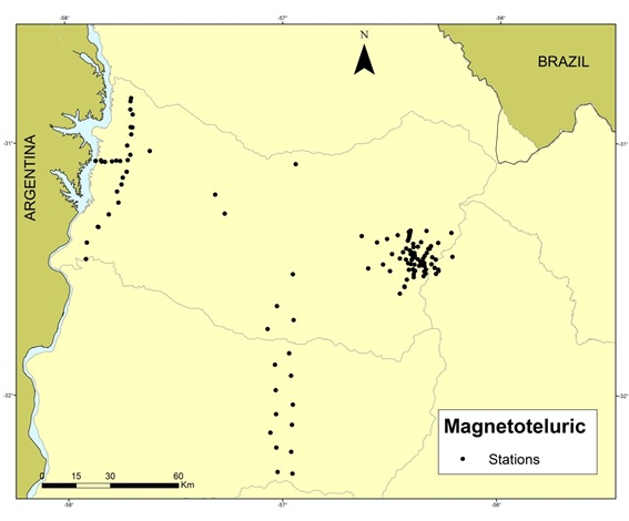
Location of magnetoteluric stations in Norte Basin
The magnetoteluric data were acquired between 1950 and 1956, surveying the NW region of the Norte Basin.
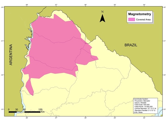
Map showing the area covered by magnetometric survey